

Comparing Modern Land Surveying Tools: Why Drone Tech Matters
Land surveying is a critical step in real estate, construction, and land investment. Whether you are buying, subdividing, or developing land, accurate measurements and mapping are essential. Over the years, surveying methods have evolved from traditional manual tools to advanced digital technologies. Today, drone surveying (UAV mapping) is transforming how land is measured, analyzed, and developed.
In this guide, we compare modern land surveying tools and explain why drone technology is becoming a game-changer in Kenya’s real estate and land investment sector.
1. Traditional Land Surveying Methods
Before modern technology, land surveying relied heavily on manual tools such as:
- Measuring tapes
- Chains
- Optical levels
- Theodolites
These tools required physical presence on the land and were often time-consuming.
Limitations of Traditional Methods
- Slow data collection
- Human error in measurements
- Difficult to use on rough terrain
- Limited accuracy over large areas
- Labor-intensive
While traditional surveying is still used today, it is gradually being replaced by more efficient technologies.
2. Total Stations: Improved Accuracy
The introduction of total stations marked a major improvement in surveying.
A total station is an electronic device that combines:
- Electronic distance measurement (EDM)
- Angle measurement
- Data recording
Advantages
- Higher accuracy than manual tools
- Faster data collection
- Digital storage of measurements
- Suitable for construction projects
Limitations
- Requires line-of-sight visibility
- Still time-consuming for large land areas
- Needs skilled operators
Total stations are widely used in Kenya, especially for subdivision and construction surveys.
3. GPS & GNSS Surveying Technology
Modern surveyors now use GPS (Global Positioning System) and GNSS (Global Navigation Satellite Systems) to determine land positions using satellites.
Benefits
- High accuracy (centimeter-level with RTK systems)
- Faster data collection
- Works over large areas
- Reduces human error
Limitations
- Requires satellite signal (may be affected by trees/buildings)
- Expensive equipment
- Technical expertise required
GPS surveying is ideal for mapping large parcels of land and is commonly used in infrastructure and land registration projects.
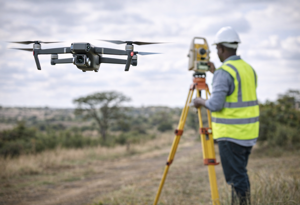
4. Drone Surveying Technology (UAV Mapping)
Drone technology has revolutionized land surveying by allowing surveyors to collect data from the air using unmanned aerial vehicles (UAVs) equipped with cameras and sensors.
Drones capture high-resolution images that are processed into:
- Orthomosaic maps
- 3D terrain models
- Digital elevation models (DEMs)
5. Why Drone Technology Matters in Land Surveying
1. Speed and Efficiency
Drones can survey large areas in minutes compared to days using traditional methods.
This makes them ideal for real estate developers, land investors, and surveyors working on large projects.
2. High Accuracy
Modern drones use advanced GPS systems and software to produce highly accurate maps.
This helps in:
- Plot boundary identification
- Subdivision planning
- Construction layout
3. Cost-Effective
Although drone equipment may seem expensive, it reduces long-term costs by:
- Saving time
- Reducing labor
- Minimizing errors
For large projects, drone surveys are often cheaper than manual methods.
4. Access to Difficult Terrain
Drones can easily survey areas that are difficult or dangerous to access, such as:
- Swamps
- Forests
- Steep slopes
- Rocky terrain
This makes them very useful in Kenya, where land terrain can vary greatly.
5. Better Visualization
Drone surveys provide high-resolution aerial images and 3D models, making it easier for investors and developers to understand the land.
This is especially useful for:
- Marketing plots
- Planning developments
- Monitoring construction progress
6. Improved Decision Making
With accurate aerial data, land buyers and developers can make better decisions regarding:
- Land suitability
- Drainage systems
- Road planning
- Environmental impact
6. Comparing Surveying Tools
| Tool | Accuracy | Speed | Cost | Best Use |
|---|---|---|---|---|
| Traditional tools | Low | Slow | Low | Small simple surveys |
| Total station | High | Moderate | Medium | Construction & subdivision |
| GPS/GNSS | Very high | Fast | High | Large-scale mapping |
| Drone surveying | Very high | Very fast | Medium–High | Large land & development projects |
Drone surveying stands out because it combines speed, accuracy, and visualization, making it ideal for modern land investment.
7. The Future of Land Surveying in Kenya
As technology continues to evolve, drone surveying is expected to become more common in Kenya due to:
- Growing real estate development
- Increased demand for accurate land data
- Adoption of digital mapping systems
- Faster project timelines
Many surveying firms and land investment companies are already integrating drones into their operations to improve efficiency and service delivery.
Conclusion
Modern land surveying has moved far beyond manual tools. While traditional methods and total stations are still useful, drone technology is leading the future of land surveying.
Its ability to provide fast, accurate, and detailed data makes it an essential tool for land investors, developers, and surveyors.
For anyone buying or developing land, working with professionals who use modern surveying tools especially drones ensures better planning, reduced risks, and smarter investment decisions.
As the real estate market continues to grow, embracing technologies like drone surveying will be key to staying ahead in land investment.